
It has viaducts, a tunnel and no shortage of controversy, but the amazing Batheaston Bypass doesn’t really work. What went so wrong when Bath’s traffic problem is obvious to everyone?
Imperfectly Odd is our occasional series of blog posts exploring strange and unexpected stories from the UK road network. This time we’re paying a visit to Bath, where the traffic is awful, but the city’s only bypass fails to bypass the city.
This might be the ultimate example of why you should either finish the job or not bother starting: without all the other things that were meant to accompany it, the Batheaston Bypass is just a jigsaw piece without the rest of the puzzle. But it remains impressive for its fabulous engineering, and well worth a look if you’re ever in the area.
What’s so odd about the Batheaston Bypass?
Bath is an ancient city, a Roman spa town with streets of fine Regency buildings. Its architecture and its location in a steep-sided valley make it pleasingly picturesque and compact, but are also a recipe for traffic congestion.
To the east of the city is the only concession to modern roadbuilding, which is the dual carriageway Batheaston Bypass. It begins on the A46 just north of Swainswick, descends the hill in a short tunnel with a remarkable gradient, passes through a grade-separated junction and over an enormous viaduct spanning the River Avon, then turns east through Batheaston Meadow to reach the A4 towards Chippenham.

Its name tells you why it doesn’t solve Bath’s problems - it is not a bypass for Bath at all, but for the village of Batheaston, which in fairness has been thoroughly relieved of through traffic. But it was meant to be the first component of a plan to remove through traffic from Bath as well, linking the A36 trunk road from Southampton and Salisbury to the M4, fixing at a stroke problems on the A4, A36, A46 and easing the heavy traffic using the little toll bridge at Batheaston.
This is why it makes a through route from the A4 in the east to the A46 in the north, even though most traffic doesn’t go that way: it was designed for traffic flows as they would be, not as they are.
Climbing out of the Bath
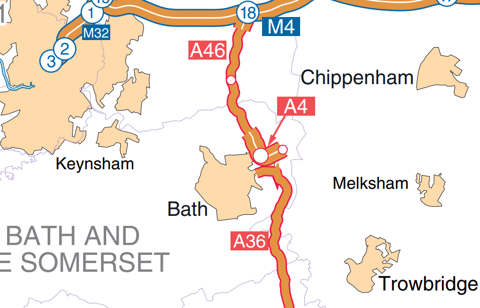
Historically, Bath is the meeting point of the A4, A36 and A46. Traffic on those major roads has always had to go through the city to get from one to another, and that’s true even today. The A4 is no longer a trunk road, since the M4 replaced it in the early 1970s, but the other two are, and if you look at a map of the modern trunk road network you’ll see a very strange thing: the trunk roads approaching Bath don't meet each other. There’s just a gap.
At their closest point, the two trunk roads are less than 450m apart. But to drive between them, you either have to go through the city, on roads maintained by the local council and subject to a Clean Air Zone charge if you're in a van, bus or heavy goods vehicle; or you go over the toll bridge at Batheaston, which is congested and can only take light vehicles anyway.
Closing the gap is difficult because the geography of Bath does not lend itself to simple roadbuilding. It had been on the “too difficult” pile for too long, because any link between the A36 and A46 would have to go through difficult terrain, sensitive landscapes and protective locals.
By the mid-1980s, with roadbuilding bravado at an all-time high, a bold plan was finally developed. The A46 would be dualled, forming a modern expressway from the M4 to Bath. It would use a tunnel to get down the steep hill to the Avon Valley, where it would interchange with the A4. Then a new bridge would cross the river to reach the A36, which in turn would see a series of improvements all the way through Somerset.
That was a tall order, so it would happen as a series of phased improvements. The first of them was the “Swainswick-Batheaston Bypass”, the central component of the project incorporating the tunnel down the hill, the crossing of the Avon and all the connections to the A4. It had the advantage that it made some sense as a road in its own right, as a bypass of the A4 through Batheaston, though that wasn’t the main problem in this area.

Work started on the new bypass in 1993, at a cost of £51 million. It was opened in July 1995 by John Watts MP, Minister for Railways and Roads.
Blocked at every turn
Even before the first shovels struck the ground, the grand project had its critical connection amputated. The Swainswick-Batheaston Bypass scheme was supposed to include a connection over to the A36, but in 1990 that was thrown out by unhappy local residents at the public inquiry.
Their complaint was not just against a road carving through the meadows east of Bathampton. They were also concerned that the A36 south from there was in no fit state to carry ever greater volumes of traffic. Any connection that would speed up journeys between the A46 in the north and A36 in the south would overwhelm the substandard and subsidence-prone road towards Warminster.

As a result, the A36 link was canned, and without it, the project failed to meet its most important aim of bypassing Bath. Construction went ahead with just the connections between the A4 and A46. To get from either of them to the A36, traffic had to come off the new bypass, enter Bath on the A4, and pass through the city centre - just like it had always done.
The week before he opened the bypass, John Watts stood up in Parliament to announce that all was not lost: there was a new plan to join everything up.
…in the review last year, we placed the East of Bath to Beckington scheme, as well as the Wylye to Codford Improvement, in our longer-term programme. We will bring those schemes forward into the main programme when funding permits.
The east of Bath to Beckington scheme will bypass Bradford on Avon and link the Batheaston and Beckington bypasses.

This new project avoided further damage to Batheaston Meadow, and avoided piling traffic onto the existing A36, by completely bypassing ten miles of it. It would begin at the eastern end of the Batheaston Bypass, with major improvements to the A363, an eastern bypass of Bradford-on-Avon, and a long new length of road to reach the A36 at Beckington, where a new bypass had just been opened. A route was selected and published for this project.
At the same time, the Government was also developing plans for the A46 Tormarton to Upper Swainswick scheme, which would have seen a continuous high-standard dual carriageway to replace the A46 from the M4 at Tormarton all the way to the new Batheaston Bypass. A route was selected for this too, and ground investigations were started.
Neither came to pass. Local opposition to roadbuilding around Bradford-on-Avon, along with the realisation that the “bypass” was really there to serve the A36 and would do little for Bradford itself, placed pressure on the Government, not least because its own MPs from the area were lobbying against it. The East of Bath to Beckington scheme was formally abandoned in 1996, just a year after the Batheaston Bypass opened. The A46 dualling project was abandoned for environmental reasons shortly afterwards.
There is still talk, sometimes, of doing something to link the A36 to the Batheaston Bypass. On the map it’s an enticingly short hop from one to the other, and the benefits are obvious. But nobody can find a way to do it without hitting obstacles that have proven immovable.

The 2004 Bristol/Bath to South Coast Study looked again at the A36-A46 corridor, and again found that it was a route with lots of potential that was let down by (among other things) the gap at Bath. It proposed a link between the A36 at Bathampton and the A363 just south of the Batheaston Bypass, but the study itself abandoned this idea because of the environmental issues it would cause and the engineering difficulty in building it.
Today it still gets talked about, but there is still nothing on the table to discuss. The Batheaston Bypass remains a strange folly, where almost all its traffic exits for the A4 into Bath, because the only way to get anywhere is still to head into the city.
The most glorious folly
It might not do what it was supposed to, and it might now never be connected to any bigger road improvements. That makes it Imperfectly Odd, but it doesn’t make it worthless. In fact, if you visit, you’ll discover one of the UK’s little-known triumphs of highway engineering, and a surprisingly enjoyable drive as the dual carriageway speeds downhill through a tunnel, a sweeping underpass and a soaring viaduct. Let’s take a look at what’s there.
At its northern end, the A46 is an ordinary country road that widens suddenly to form a modern dual carriageway. This end was meant to be temporary, awaiting the extension of the dual carriageway all the way to the M4.

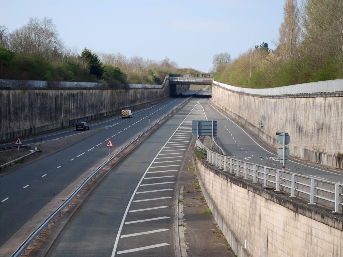
After the junction for Swainswick - which provides access to the old A46 through the village - the bypass enters a walled cutting and heads quite suddenly downhill. The gradient is hard to capture in a photograph, but driving southbound this is the A-road equivalent of the moment a rollercoaster goes over the top and plummets down a long descent.

Still descending, the bypass enters a short cut-and-cover tunnel, properly called the Bailbrook Underpass. It passes below Bailbrook Lane and shields the nearby houses from the trunk road as it passes through a peaceful residential area.
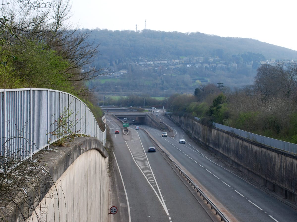
From the top of the tunnel's southern portal, the bypass can be seen heading further downhill into an underpass below the A4, and beyond it, Bathampton Down rising up on the other side of the Avon. The view here is magnificent, but normally hidden behind a tall wooden fence to reduce traffic noise. If you want to see it you'll need to visit when National Highways are on site for maintenance work, and ask politely if you can take a look through the gate.
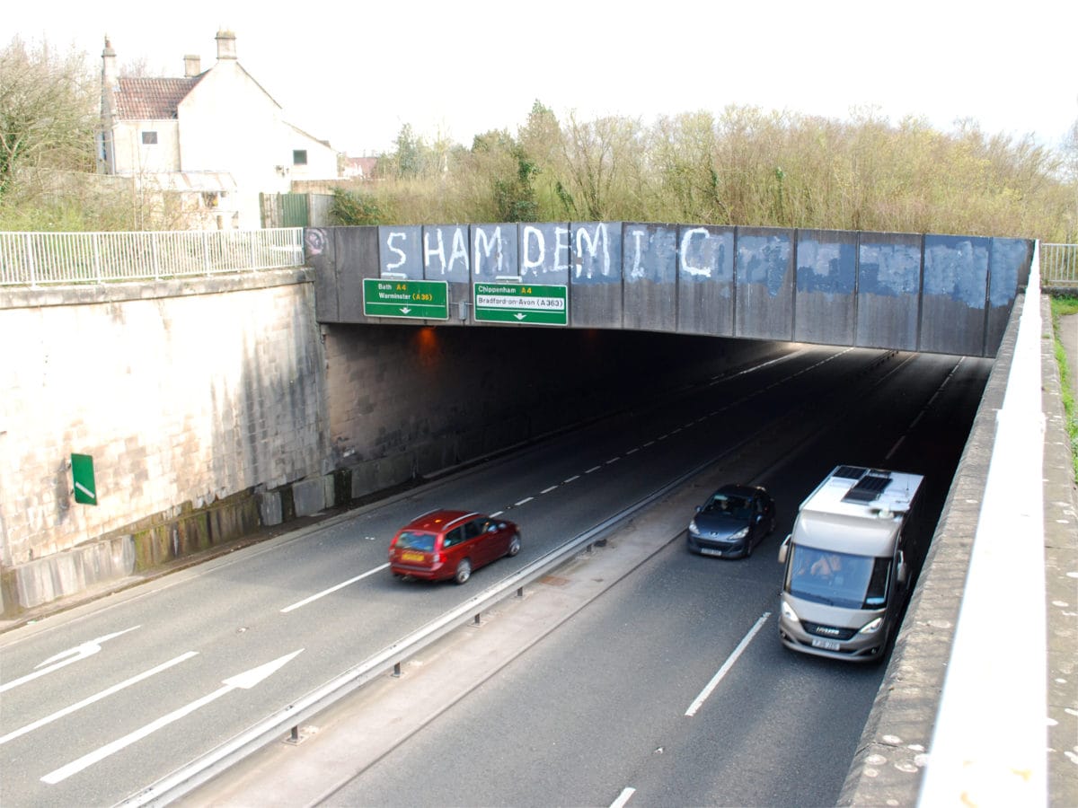
From the bridges of the A4 interchange, there's a view back up the hill and through the tunnel. Even here the unusually steep gradient is hard to capture. The volume of traffic leaving the bypass to head into Bath is indicated by the fact that only one lane of traffic is marked out under the bridge; had the link to the A36 been built far more traffic would stay on here and avoid Bath entirely.
In the other direction, to the south of the interchange, the bypass immediately crosses the Avon and begins curving east into Batheaston Meadows. The bypass itself, and the two south-facing sliproads from the junction, cross the river on four parallel viaducts.

From underneath the true scale of these four structures is easier to see - they're much bigger, and much longer, than is apparent from the road, and cast a shadow over a large area of the river and its banks.

The road straightens up after the river crossing, and joins the north side of the Great Western Main Line railway through Batheaston Meadow. This section cut through an environmentally sensitive area and was very controversial while the road was in planning.

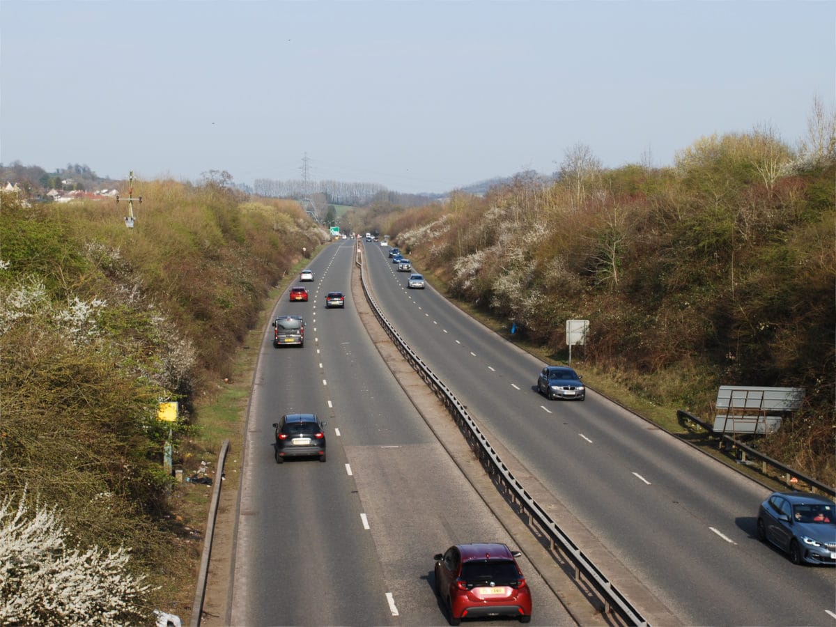
Looking east from Mill Lane bridge, the rest of the bypass is an almost ruler-straight run to its terminal roundabout, where it meets the old road through Batheaston and the A363 towards Bradford-on-Avon. If the link to the A36 had been built, as originally designed, its junction would have been in the foreground of this picture.
It may not be a very long stretch of road, but it's eventful from start to finish, and the plummeting descent through Swainswick is a genuinely enjoyable drive. The Batheaston Bypass doesn't do all the things it was supposed to, and the trunk roads east of Bath may never meet up - but that's precisely what makes it so weirdly fascinating. In every sense it's Imperfectly Odd.
Comments
Today the argument for the bypass relies heavily on the idea that there is a significant amount of vehicle movement between the A4 and A36 (2000+ vehicles daily). When the Bath Clean Air Zone was being proposed, they implemented a 45 ANPR camera two week study and then released the data to the public.
My analysis showed that only about 1000 vehicles used the North/South travel route through the city and there was more traffic heading east west through the city. https://docs.google.com/document/d/1-BHi_hj36RwFoWaCZkhzdWLpt8iKk0jrvyP…
The bypass rears its head regularly but the CAZ study was very much the final nail in the coffin.
Note that the A36 camera was set before Brass Knocker Hill and not down at Beckford so even the 1000 vehicles per day is a high value.
Hope this is useful!
It's really interesting, and not at all what I expected. Thank you!
I was in the area last summer - and can vaguely remember pre-bypass as well from previous trips.
It does a very good job of keeping traffic out of Batheaston and this is the right thing to do. But I think the initial plan of getting the A36 onto the bypass probably wouldn't have been a great idea had it happened. First of all, what appears to be a restricted access junction wouldn't take all the traffic out of Bath, you'd assume that it wouldn't be immediately obvious for A36 traffic heading towards the A46 and M4 or to the A4 eastbound and vice versa being the dominant route, so the other would lose out. Secondly, the proximity to the marshes and railway line would make the junction tight anyway. Thirdly, there would be serious weaving issues with the A4 junction into Bath which takes a fair amount of traffic (as it's a TOTSO) and takes up a lot of space due to the need to go down a steep hill and then cross the Avon meaning traffic leaving to join the A36 would have conflicts with that coming on from Bath. Admittedly, I think that there would probably be less traffic joining if the A36 joined the bypass, but probably not much - Bath is a fairly sizeable city with a large tourist throng after all.
It's a busy place with no real obvious solution. Without access to any surveys, I'd estimate a fair amount of traffic wouldn't really be eliminated from the middle by cutting the A36-A4 corner anyway, which admittedly, is already cut off further in by the Cleveland Bridge, which isn't very far out of the way from the proposed diversion. So either a lot of traffic is actually going into Bath itself, or is heading through it to leave on the A4 to Bristol or onto the A39, which aren't easy fixes. For the Bristol traffic you could probably do further improvements on the A46 and A420, and send it in a different way. Better still would be to renumber the roads through Bath, take the A4 over the Cleveland Bridge to the current A36 south of the Avon, and then carry this through to where the A36 currently meets the A4 west of Bath - there's little need to have the A4 - which sounds more important than the A36 - going right through the middle of the city.
The junction for the A36 connection, as proposed 1986-1990, allowed all movements where it met the Batheaston Bypass, though admittedly that's not very obvious from the map above. It would have had a very tight loop for traffic joining the bypass eastbound.
Wow, an article on a road in my hometown! This sums up the situation really well, just thought I'd add a couple of other bits of information for further context.
Firstly, I believe the full title of the bypass is the Batheaston and Swainswick bypass. Batheaston has clearly benefitted from the bypass, but so has the tiny village of Swainswick (at the northern end of the dual carriageway) as the old main road between here and London Road in Larkhall is quite narrow and bendy as well as residential.
Secondly, the need for an A36-A46 link road is based on the assumption of significant freight traffic between the South Coast, especially Southampton, and Wales. However, much of this traffic goes via the A350 from Warminster to the M4 north of Chippenham (or via the A34/M1), especially since the introduction of an 18t weight limit on Cleveland Bridge in 2020 and the CAZ earlier this year which charges HGVs. The A350 route is higher quality than the A36 between Warminster and Bath thanks to upgrades like the Semington bypass and the steady programme to dual the Chippenham bypass. Though it has its own bypass problem at Westbury with similar environmental concerns due to the proximity of an eastern route to the Salisbury Plain and the White Horse, it's fair to say a western bypass of Westbury (!) is much less controversial than an A36-A46 link.
Finally, the A36-A46 link isn't the only controversial road project in this area: Bathampton Meadows, which the bypass skirts past near the Mill Lane bridge, may ring bells as this was the site of a recent controversy over a proposed P&R. This was very unpopular locally which eventually caused the council to cancel it, and the project now seems very unlikely as the land was bought/transferred to the National Trust soon after the cancellation. But I'm sure both projects will keep cropping up in the future, perhaps combined together or with other flourishes: my favourite was a suggestion to integrate a link road with a P&R station at Bathampton on one or both of the railway lines - not sure how GWR/Network Rail would feel about that... Great write-up as always and looking forward to the next article!
I would expect that much of the traffic between Bristol or South Wales and the south coast goes via the M4 and A34, which bypasses the additional bottleneck (and low bridge) of Salisbury. If it was an important enough road between these two places, Bristol and Southampton would be signposted from either end, but they aren't. If you drive south on the A46 from the M4, the distance sign (last time I went that way, at least) mentioned Bath, Chippenham and Exeter (via the A367 Fosse Way) but not Southampton. The A36 is a prime target for detrunking; it's a poor-quality road and just not suitable for a long-distance all-purpose route.
Having lived in Bath for the first 4 years of my life and having relatives who still live there, I've been well aware of the problem with the bypass for a long time. There was due to be a spur built to its south but due to huge objections from local residents the proposal sadly failed. I believe the objectors cited environmental grounds but at the same time the half-baked bypass that was built does very little to solve the congestion on Bath's A4 London Road which remains a bottleneck and which probably causes far more pollution than what a free moving bypass in the direction of Warminster would have done (Bath is quite prone to pollution due to its geography). Based on my observation, about 2/3 of the traffic heading westwards towards Bath along the London Road is heading back out along Bath's Warminster Road, the route that the unbuilt spur would have bypassed. Even more recently Bath has introduced a clean air zone charge that applies to commercial vehicles, meaning that nearby towns such as Bradford on Avon may have since become bottlenecks, and I know the roads around it are definitely not designed to cope with HGVs.
I saw some signs displayed in home and local business windows around the Batheaston area about 3-4 years ago protesting against a proposed park and ride site that Bath's council wanted to build in the area. In my opinion neither this nor the abandoned spur proposals would have had a particularly detrimental impact on the landscape, and they would have both reduced congestion within Bath. I think there are some habitats in the area that protestors wanted to preserve but I believe it would have been possible to have built either of these schemes in a sustainable manner which did as much as possible to protect the habitats and blend into the surroundings.
Good article. Coming down the A46 in 5th and foot off the accelerator its hard to keep to the 50mph limit and needs a wary eye for police cars in the set back lay-by and then the speed camera. Recently on the single right lane through the tunnel and to the A4 junction I had an artic trying hitch a ride in my boot. Needless to say, after the viaduct and a return to 2 lanes it then overtook me at 60+ before slamming his brakes on for another speed camera (I believe all Wiltshire cameras are non functioning).
Traffic is light and I find heading west that most traffic comes off the by-pass and goes into Bath. The A36 south of Bath is once again (July 2022) having major stabilisation works as the road climbs the edge of the valley. It's the same on the other side of the valley where last year the A363 to BoA also needed stabilisation works, so if the 2nd link scheme was ever built it would have the same problem. For those of us living east and south east of Bath, then a P&R would be good, though if practical I take the train.
What Bath needs is a Millau-style viaduct crossing the Avon linking the A36 to the A46 but that’s never gonna happen for a road linking Salisbury with the M4! Would be spectacular and provide amazing views of the hills and Bath skyline though!
Thank you for the article but it's stirred up some memories for me. I lived in Batheaston as a kid, up to 1977. Traffic was always an issue but our little by-pass was supposed to be part of a bigger scheme. There were talks of a massive tunnel under Bath but nothing came of that. It was probably 30 years before I saw the by-pass in reality and it greatly saddened me. A true scar on the landscape. Acres of countryside turned over to yet more roads. Places where I'd played, such as Bathampton meadows, destroyed. And what's it achieved?
It has actually achieved quite a lot for Batheaston, which is now really quite quiet,at least when I've been there. While I understand how the change affects you emotionally, I have to say that I really find this stretch of road quite aesthetically satisfying. But I hardly knew the area in 1977, and while I grew to know Bath well in the late 1970s, it was the city centre and the area around Widcombe that I knew. Many years later I worked at the University of Bath and lived on/in Odd Down. I do love Bath, though I now live in Bristol. I do think that some type of Bath Relief Road needs to be built and I think that there needs to be some type of road between Beckington and Keynsham. However, somehow it needs to avoid areas of outstanding beauty to the south and southwest of Bath. Maybe that could be achieved by putting much of the road in a cut and cover tunnel.
I sometimes have to travel North from Poole to the Severn Bridge. Trying to avoid Bath is difficult, but latterly I have used the B3109 from Beckington to Bradford on Avon, and then the A363. It slightly concerns me that I am simply substituting driving through a large historic town by driving through a small one (but try to go North by train from Poole!), so the longer Batheaston to Beckington would have been ideal for me.
Beckington to Keynsham would be a sensible alternative.
Add new comment
Sources
- Intention to form part of a north-south bypass: Hansard HC Deb. vol.101 col.667, 14 July 1986.
- Scheme start date 1993 and cost: Hansard HC Deb. vol.218 col.489, 4 February 1993.
- East of Bath scheme and wider route strategy circa 1996: Hansard HC Deb. vol.280 col.1124, 4 July 1996.
- History of various projects and studies etc: A36/46 Link Road: Case Review [PDF], Avon Valley Action Group, August 2016.
Picture credits
- Extract from National Highways Network Management Map is taken from "Our roads", National Highways.
- Base map for plan of East of Bath to Beckington Scheme © OpenStreetMap contributors.

This is a section of road I use quite regularly. It's always struck me that it would be brilliant to close the road for a day between the A4/A363 roundabout and the A46/A420 roundabout and hold a motor race on it. I'd quite like to see a Formula E race on that stretch of road!