Coventry Ring Road:
Route map

This map shows the route of the Ring Road, not perfectly to scale but accurately enough to demonstrate the size of its junctions in comparison to the spaces between them. It also includes a couple of roads inside the ring to demonstrate just how tightly the road is drawn around the city centre.
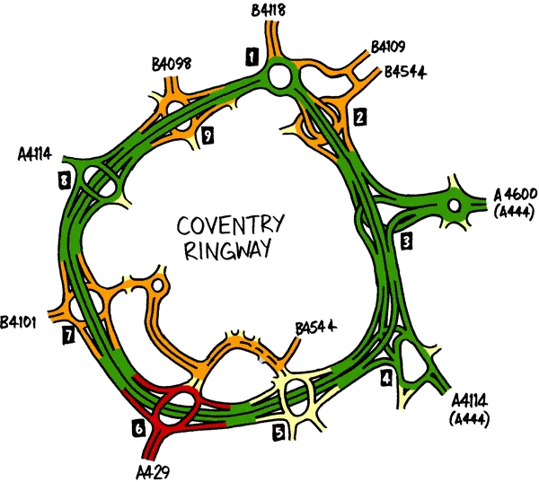
The route of the Coventry Ring Road. Click to enlarge

In this section

What's new

We need to talk about Wisley

National Highways are spending a third of a billion pounds rebuilding one of the most congested junctions on the M25. Is it money well spent?

Oxford's Ground Zero

Oxford's Zero Emission Zone is just a trial, but transport policy in Oxford has become the catalyst for pitched battles and drawn in protestors from across the UK. What's happening to this genteel university town?

2023 end of year message

It’s been a quiet year for Roads.org.uk, but we will be back to our usual schedule soon.

Share this page

Have you seen...

Abbreviations

How do you describe a road? One way is to use these engineering abbreviations, much loved by the UK's community of road enthusiasts.

About this page

Published

Last updated