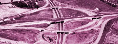
This is the story of the most astonishing and destructive thing never to happen to London. It was far-reaching and visionary; planning on a scale rarely seen in this country. It was a transport scheme to end all transport schemes. And it was utterly unacceptable to the general public.
This section of Roads.org.uk explores the London Ringways - a proposal to drive a dense network of motorways through and around the capital. It was a plan created by successive governments in London from the 1940s through to the 1970s that would have affected life in the capital in every conceivable way, changing the way London looked and functioned.
You can explore the pages in whatever order you like, but in sequence they tell the story of the creation and destruction of one of the most audacious schemes of public works ever proposed in the UK. They then go on to explore the road plans and plot them on detailed modern-day maps road by road, section by section. At the end you can access a detailed map of everything we know so far.
New to this subject? There's a quick overview called Ringways for Beginners over at our sister site, Pathetic Motorways.
Some pages are not yet available
Some parts of this mini-site are still in production. Each page is made available here once it's ready to go.
London with the Ringways
Coming soon
Driving the Ringways
Coming soon


